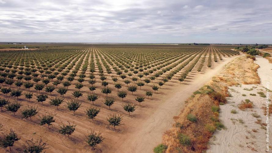
You've been led to believe that global warming leads to rising sea levels. This, in turn, would lead to the disappearance of low-lying atolls. That would certainly be a disaster for communities that are living on those islands.
But, now, against all odds, most low-lying reef islands actually appear to be growing in some parts of the world, despite rising sea levels, increasing their footprint and defying calamatous predictions.
Geomorphologist Murray Ford led a team of researchers who examined Jeh Island, one of the 56 islands that make up the Ailinglaplap Atoll in the (Republic of the) Marshall Islands in the Pacific, itself considered one of the most endangered nations on Earth.
Ford and his team pored over old aerial and new satellite imagery of the island from above and made the startling discovery that not only has Jeh increased in total land area by 13 percent since 1943, it may actually have once been four separate islands which have now morphed together due to net land-mass gains[1].
”Counter to predictions, popular media coverage and political proclamations, recent studies have shown the majority of reef islands studied have been stable or have increased in size since the mid-20th century," Ford, explains.
According to the geomorphologist and his colleagues, the more dire sea-level rise predictions were based on the assumption that islands are static and unchanging and would therefore simply drown once the tides rose enough.
The research team found that the islands grew by organic material formed by the reef and that sediment washed ashore by the tides.
"The coral reefs which surround these islands [are] the engine room of island growth, producing sediment which is washed up on the island shoreline," Ford explains. "Healthy coral reefs are essential for this process to continue into the future."
Research dating back as far as 2018 found that among 30 coral atolls, accounting for over 700 islands in total, 88.6 percent remained stable or increased in size in recent decades, while none lost land overall.
[1] Ford et al: Active Sediment Generation on Coral Reef Flats Contributes to Recent Reef Island Expansion in Geophysical Letters - 2020. See here.
Shift in SE Asian monsoon resulted in dry Sahara 4,000 years ago
Today, the Southeast Asian Monsoon provides critical water resources to more that 600 million people each year. Even slight variations in the strength and/or timing of the monsoon can have profound impacts on the region. But there's a problem, because while we do know more, very little is known about the range and mechanisms of Southeast Asian monsoon variability, particularly on timescales such as the Holocene. The mid- to late Holocene, roughly six to four thousand years ago, was characterized by one of the largest climate shifts since the last glacial termination.
New evidence from stalagmites from a cave in Laos, indicate a major decrease of monsoon rainfall in mainland Southeast Asia during the mid-to late Holocene (6,000 to 4,000 years ago). At the same time the African monsoon failed to deliver enough moisture and that signalled the end of the 'Green Sahara'[1].
It signalled the end of the 'Green Sahara' (also known as as the African Humid Period), when a vegetated northern Africa into the current desert landscape. It also resulted in the collapse of the Akkadian Empire of Mesopotamia, the de-urbanization of the Indus Civilization, and the spread of pastoralism along the Nile, as people were driven from the arid Sahara.
Computer modelling experiments show that reduced vegetation and increased dust loads during the Green Sahara termination shifted the Walker circulation, the air flow in the tropics in the lower atmosphere, eastward and cooled the Indian Ocean, causing a reduction in monsoon rainfall in mainland Southeast Asia. The results of the research indicate that reduced vegetation and increased dust from the Sahara may have been the catalyst for societal shifts in mainland Southeast Asia.
The megadrought it caused would have led to mass population movements and the adoption of new, more resilient subsistence strategies. It may even have led to the inception of Neolithic farming in mainland Southeast Asia, the researchers have concluded.
So, maybe as a result of an extreme El Niño, the Walker circulation was influenced, which resulted in an decrease in monsoon activity in Southeast Asia and Northern Africa. This in turn resulted in an arid and dusty Sahara which now feeds the Amazon rainforest and forced people in Southeast Asia to migrate.
[1] Griffiths et al: End of Green Sahara amplified mid- to late Holocene megadroughts in mainland Southeast Asia in Nature - 2020
New evidence from stalagmites from a cave in Laos, indicate a major decrease of monsoon rainfall in mainland Southeast Asia during the mid-to late Holocene (6,000 to 4,000 years ago). At the same time the African monsoon failed to deliver enough moisture and that signalled the end of the 'Green Sahara'[1].
It signalled the end of the 'Green Sahara' (also known as as the African Humid Period), when a vegetated northern Africa into the current desert landscape. It also resulted in the collapse of the Akkadian Empire of Mesopotamia, the de-urbanization of the Indus Civilization, and the spread of pastoralism along the Nile, as people were driven from the arid Sahara.
Computer modelling experiments show that reduced vegetation and increased dust loads during the Green Sahara termination shifted the Walker circulation, the air flow in the tropics in the lower atmosphere, eastward and cooled the Indian Ocean, causing a reduction in monsoon rainfall in mainland Southeast Asia. The results of the research indicate that reduced vegetation and increased dust from the Sahara may have been the catalyst for societal shifts in mainland Southeast Asia.
The megadrought it caused would have led to mass population movements and the adoption of new, more resilient subsistence strategies. It may even have led to the inception of Neolithic farming in mainland Southeast Asia, the researchers have concluded.
So, maybe as a result of an extreme El Niño, the Walker circulation was influenced, which resulted in an decrease in monsoon activity in Southeast Asia and Northern Africa. This in turn resulted in an arid and dusty Sahara which now feeds the Amazon rainforest and forced people in Southeast Asia to migrate.
[1] Griffiths et al: End of Green Sahara amplified mid- to late Holocene megadroughts in mainland Southeast Asia in Nature - 2020
The Dangers of Fugitive Dust
Fugitive dust is an environmental air quality term for very small particles suspended in the air, the source of which is primarily the Earth's soil. It does not include particulate matter from other common sources, such as vehicle exhaust or smokestacks.
Fugitive dust results from dry conditions where there is insufficient moisture content in the ground to hold the soil together.
Fugitive dust arises from the mechanical disturbance of granular material exposed to the air. Dust generated from these open sources is termed 'fugitive' because it 'escapes' and is not discharged to the atmosphere in a confined flow stream from a exhaust pipe or chimney.
Common sources of fugitive dust include unpaved roads, agricultural tilling operations, aggregate storage piles, and heavy construction operations. Fugitive dust particles are mainly minerals common to soil, including silicon oxides, aluminium, calcium, and iron.
Thus, the dust-generation process is caused by two basic physical phenomena: [a] Pulverization and abrasion of surface materials by application of mechanical force through implements (wheels, blades, explosion, etc.) and [b] Entrainment of dust particles by the action of turbulent air currents, such as wind erosion of an exposed surface by wind speeds over 20 kilometers per hour.
About half of fugitive dust particles are larger than 10 microns in diameter and settle more quickly than the smaller particles. The U.S. Environmental Protection Agency (EPA) estimated that fugitive dust was responsible for 92% of the PM-10 emissions in the United States in 1995.
It's just dust, you might argue, but danger hides in the soil. A family of fungi, called Coccidioides, lingers in the soil and dust in the United States, Meso and South America. When you inhale the fugitive dust, you might also inhale the fungus, leading to a potentially fatal fungal pneumonia. The disease is called coccidioidomycosis or Valley Fever.
The latest numbers show that in 2018, about 15,600 people were diagnosed with Valley Fever in the United States, with most cases coming out of southern Arizona and California’s San Joaquin Valley. But these numbers only reflect known cases reported to the Centers of Disease Control. Experts think that number is probably much higher.
Symptoms include fatigue (tiredness), cough, fever, shortness of breath, headache, night sweats, muscle aches or joint pain, rash on upper body or legs.
Fugitive dust results from dry conditions where there is insufficient moisture content in the ground to hold the soil together.
Fugitive dust arises from the mechanical disturbance of granular material exposed to the air. Dust generated from these open sources is termed 'fugitive' because it 'escapes' and is not discharged to the atmosphere in a confined flow stream from a exhaust pipe or chimney.
Common sources of fugitive dust include unpaved roads, agricultural tilling operations, aggregate storage piles, and heavy construction operations. Fugitive dust particles are mainly minerals common to soil, including silicon oxides, aluminium, calcium, and iron.
Thus, the dust-generation process is caused by two basic physical phenomena: [a] Pulverization and abrasion of surface materials by application of mechanical force through implements (wheels, blades, explosion, etc.) and [b] Entrainment of dust particles by the action of turbulent air currents, such as wind erosion of an exposed surface by wind speeds over 20 kilometers per hour.
About half of fugitive dust particles are larger than 10 microns in diameter and settle more quickly than the smaller particles. The U.S. Environmental Protection Agency (EPA) estimated that fugitive dust was responsible for 92% of the PM-10 emissions in the United States in 1995.
![]() |
| [The fungus Coccidioides] |
The latest numbers show that in 2018, about 15,600 people were diagnosed with Valley Fever in the United States, with most cases coming out of southern Arizona and California’s San Joaquin Valley. But these numbers only reflect known cases reported to the Centers of Disease Control. Experts think that number is probably much higher.
Symptoms include fatigue (tiredness), cough, fever, shortness of breath, headache, night sweats, muscle aches or joint pain, rash on upper body or legs.
Air pollution may be ‘key contributor’ to Coronavirus deaths
New research examined the relationship between [1] levels of nitrogen dioxide (NO2), a pollutant produced mostly by older diesel vehicles, [2] weather conditions that can prevent dirty air from dispersing away from a city and [3] Coronavirus fatalities[1]. Long-term exposure to NO2 can cause severe health problems, such as hypertension, diabetes, heart and cardiovascular diseases and even death.
The analysis was conducted on a regional scale and combined with the number of deaths taken from 66 administrative regions in Italy, Spain, France and Germany. Results show that out of the 4443 fatality cases, 3487 (78%) were in five regions located in north Italy and central Spain. Additionally, the same five regions show the highest NO2 concentrations combined with downwards airflow which prevent an efficient dispersion of air pollution.
These results indicate that the long-term exposure to this pollutant may be one of the most important contributors to fatality caused by the Coronavirus in these regions and thus maybe across the whole world.
“Poisoning our environment means poisoning our own body, and when it experiences chronic respiratory stress its ability to defend itself from infections is limited,” said Yaron Ogen, who conducted the research.
The analysis is only able to show a strong correlation, not a causal link. “It is now necessary to examine whether the presence of an initial inflammatory condition is related to the response of the immune system to the coronavirus,” Ogen said.
A separate study looked at fine particle pollution (PM10, PM2.5) in the northern Italy and found that even small increases in levels in the years before the pandemic were associated with far higher death rates if infected with the Coronavirus[2].
Did I already mention that sigarette smoke also contain those pesky fine particles (PM2.5)[3]?
[1] Ogen: Assessing nitrogen dioxide (NO2) levels as a contributing factor to coronavirus (COVID-19) fatality in The Science of the Total Environment – 2020. See here.
[2] Conticini et al: Can atmospheric pollution be considered a co-factor in extremely high level of SARS-CoV-2 lethality in Northern Italy? in Environmental Pollution - 2020. See here.
[3] Jebel et al: Surface bound radicals, char yield and particulate size from the burning of tobacco cigarette in Chemistry Central Journal - 2017
![]() |
| [Dense smog over Milan] |
These results indicate that the long-term exposure to this pollutant may be one of the most important contributors to fatality caused by the Coronavirus in these regions and thus maybe across the whole world.
“Poisoning our environment means poisoning our own body, and when it experiences chronic respiratory stress its ability to defend itself from infections is limited,” said Yaron Ogen, who conducted the research.
The analysis is only able to show a strong correlation, not a causal link. “It is now necessary to examine whether the presence of an initial inflammatory condition is related to the response of the immune system to the coronavirus,” Ogen said.
A separate study looked at fine particle pollution (PM10, PM2.5) in the northern Italy and found that even small increases in levels in the years before the pandemic were associated with far higher death rates if infected with the Coronavirus[2].
Did I already mention that sigarette smoke also contain those pesky fine particles (PM2.5)[3]?
[1] Ogen: Assessing nitrogen dioxide (NO2) levels as a contributing factor to coronavirus (COVID-19) fatality in The Science of the Total Environment – 2020. See here.
[2] Conticini et al: Can atmospheric pollution be considered a co-factor in extremely high level of SARS-CoV-2 lethality in Northern Italy? in Environmental Pollution - 2020. See here.
[3] Jebel et al: Surface bound radicals, char yield and particulate size from the burning of tobacco cigarette in Chemistry Central Journal - 2017
Dust storms on Mars
If you've seen the movie 'The Martian', starring Matt Damon, you might have guessed that the weather on Mars can be pretty unpredictable.
When a huge dust storm on Mars turns up the power, it can easily turn into a gigantic weather phenomenon. During the last Martian global dust storm in 2018 orbiting space crafts kept a close eye on the planet, getting a good look at the storm's life-cycle. The tower that rose during that storm rose as high as 70 to 90 kilometers[1].
"Global dust storms are really unusual," said David Kass, a co-author of the paper. "We really don't have anything like this on the Earth. On Mars, the entire planet's weather changes for several months."
During the 2018 storm, NASA's Mars Reconnaissance Orbiter (MRO) saw something unusual. "Normally the dust would fall down in a day or so," said Heavens. "But during a global storm, dust towers are renewed continuously for weeks." In some cases, multiple towers were seen for as long as 3.5 weeks.
The dust towers that form during these storms are warmed by the Sun and rise high into the atmosphere. Scientists think that water molecules that form Mars' wispy clouds get trapped in all that dust, and are carried high into the atmosphere.
It's similar to how a thunderstorm cloud forms during a powerful storm on Earth. But at high altitudes on Mars, solar radiation breaks apart the H2O molecules. These dust towers might explain, at least partially, how Mars lost its water over billions of years[2].
[1] Heavens et al: Dusty Deep Convection in the Mars Year 34 Planet-Encircling Dust Event in JGR Planets – 2019. See here.
[2] Heavens et al: Hydrogen escape from Mars enhanced by deep convection in dust storms in Nature Astronomy – 2018. See here.
When a huge dust storm on Mars turns up the power, it can easily turn into a gigantic weather phenomenon. During the last Martian global dust storm in 2018 orbiting space crafts kept a close eye on the planet, getting a good look at the storm's life-cycle. The tower that rose during that storm rose as high as 70 to 90 kilometers[1].
"Global dust storms are really unusual," said David Kass, a co-author of the paper. "We really don't have anything like this on the Earth. On Mars, the entire planet's weather changes for several months."
During the 2018 storm, NASA's Mars Reconnaissance Orbiter (MRO) saw something unusual. "Normally the dust would fall down in a day or so," said Heavens. "But during a global storm, dust towers are renewed continuously for weeks." In some cases, multiple towers were seen for as long as 3.5 weeks.
The dust towers that form during these storms are warmed by the Sun and rise high into the atmosphere. Scientists think that water molecules that form Mars' wispy clouds get trapped in all that dust, and are carried high into the atmosphere.
It's similar to how a thunderstorm cloud forms during a powerful storm on Earth. But at high altitudes on Mars, solar radiation breaks apart the H2O molecules. These dust towers might explain, at least partially, how Mars lost its water over billions of years[2].
[1] Heavens et al: Dusty Deep Convection in the Mars Year 34 Planet-Encircling Dust Event in JGR Planets – 2019. See here.
[2] Heavens et al: Hydrogen escape from Mars enhanced by deep convection in dust storms in Nature Astronomy – 2018. See here.
Hindus perform ceremony in river covered in toxic foam
Thousands of Hindus in New Dehli, India's capital city, waded into a sacred river on Saturday, 02 November 2019, to observe the Chhath Puja festival despite the water being covered with toxic foam.
The Yamuna, a tributary of the Ganges, is one of India's most sacred rivers but has also become one of its most polluted.
Industrial effluents and untreated sewage continue to flow into the Yamuna, despite repeated government attempts to clean the sacred river.
For many Hindus, the Yamuna remains a key water source which resonates deeply with their faith so on that Saturday they waded into the extremely polluted waters nonetheless to observe the ancient festival which is dedicated to the Sun God.
The festival is to worship the Sun God and the rituals are rigorously observed over a period of four days. They include holy bathing, fasting and abstaining from drinking water (Vratta), standing in water for long periods of time and offering prasad (prayer) and arghya (offerings) to the setting and rising sun.
The Yamuna, a tributary of the Ganges, is one of India's most sacred rivers but has also become one of its most polluted.
Industrial effluents and untreated sewage continue to flow into the Yamuna, despite repeated government attempts to clean the sacred river.
For many Hindus, the Yamuna remains a key water source which resonates deeply with their faith so on that Saturday they waded into the extremely polluted waters nonetheless to observe the ancient festival which is dedicated to the Sun God.
The festival is to worship the Sun God and the rituals are rigorously observed over a period of four days. They include holy bathing, fasting and abstaining from drinking water (Vratta), standing in water for long periods of time and offering prasad (prayer) and arghya (offerings) to the setting and rising sun.
Strong winter dust storms and the collapse of the Akkadian Empire
Fossil coral records provide new evidence that frequent winter shamals (or dust storms) and a prolonged cold winter season contributed to the collapse of the ancient Akkadian Empire in Mesopotamia[1].
The Akkadian Empire (22th to 20nd century BC) was the first united empire in Mesopotamia and thrived with the development of irrigation. Yet, settlements appear to have been suddenly abandoned ca. 4,200 years ago, causing its collapse. The area would also not experience resettlement until about 300 years later.
Past studies have shown that the Akkadian Empire likely collapsed due to abrupt drought and civil turmoil. However, the climatic dynamics which caused widespread agricultural failures and the end of an era have yet to be sufficiently explored.
Researchers made paleoclimatic reconstructions of the temperature and hydrological changes of the areas around the archaeological site of Tell Leilan, the center of the Akkadian Empire. They sampled six 4,100-year-old fossil Porites corals from the Gulf of Oman, just directly downwind. The samples were aged by radiocarbon dating and geochemically analyzed to confirm they have not been significantly altered from their present state.
The coral data was then compared to modern coral samples and meteorological information. Although it is normal for the survey area to receive a significant amount of rainfall in the winter, the coral data suggests that, during the time of the empire’s collapse, the area suffered from significant dry spells. The data before and since the collapse are furthermore comparable to modern coral data, showing the dry spells would have been sudden and intense.
The fossil evidence shows that there was a prolonged winter shamal season accompanied by frequent shamal days. The impact of the dust storms and the lack of rainfall would have caused major agricultural problems possibly leading to social instability and famine, both factors which have been previously associated with the collapse of the empire.
“Although the official mark of the collapse of the Akkadian Empire is the invasion of Mesopotamia by other populations, our fossil samples are windows in time showing that variations in climate significantly contributed to the empire’s decline,” said lead-author Tsuyoshi Watanabe.
[1] Watanabe et al: Oman corals suggest that a stronger winter shamal season caused the Akkadian Empire (Mesopotamia) collapse in Geology - 2019
The Akkadian Empire (22th to 20nd century BC) was the first united empire in Mesopotamia and thrived with the development of irrigation. Yet, settlements appear to have been suddenly abandoned ca. 4,200 years ago, causing its collapse. The area would also not experience resettlement until about 300 years later.
Past studies have shown that the Akkadian Empire likely collapsed due to abrupt drought and civil turmoil. However, the climatic dynamics which caused widespread agricultural failures and the end of an era have yet to be sufficiently explored.
Researchers made paleoclimatic reconstructions of the temperature and hydrological changes of the areas around the archaeological site of Tell Leilan, the center of the Akkadian Empire. They sampled six 4,100-year-old fossil Porites corals from the Gulf of Oman, just directly downwind. The samples were aged by radiocarbon dating and geochemically analyzed to confirm they have not been significantly altered from their present state.
The coral data was then compared to modern coral samples and meteorological information. Although it is normal for the survey area to receive a significant amount of rainfall in the winter, the coral data suggests that, during the time of the empire’s collapse, the area suffered from significant dry spells. The data before and since the collapse are furthermore comparable to modern coral data, showing the dry spells would have been sudden and intense.
The fossil evidence shows that there was a prolonged winter shamal season accompanied by frequent shamal days. The impact of the dust storms and the lack of rainfall would have caused major agricultural problems possibly leading to social instability and famine, both factors which have been previously associated with the collapse of the empire.
“Although the official mark of the collapse of the Akkadian Empire is the invasion of Mesopotamia by other populations, our fossil samples are windows in time showing that variations in climate significantly contributed to the empire’s decline,” said lead-author Tsuyoshi Watanabe.
[1] Watanabe et al: Oman corals suggest that a stronger winter shamal season caused the Akkadian Empire (Mesopotamia) collapse in Geology - 2019
Dust reveals age of the Sahara
One of the great mysteries is the moment when the Sahara came into being. Wild guesses range between 2.6 and 7.0 million years ago. Others still think that the desert was wet and green around 5,000 years ago, covered in swamps and lakes.
Now, new research indicates that the desert is around 4.6 million years old[1]. The conclusion was reached after analyzing ancient Saharan dust that had blown over to the Spanish Canary Islands—which lie off the coast of northwestern Africa in the Atlantic Ocean.
The Canary Islands are affected by a weather phenomenon known locally as the 'Calima' which occurs every year and drags vast quantities of dust from the Sahara across the Atlantic Ocean. On two of the islands - Fuerteventura and Gran Canaria - the scientists investigated sediments to identify and date of this ancient dust in so-called paleosols; buried, ancient soils.
When the Sahara was still lush and moist no (or hardly any) dust would have been able to reach the Canary Islands. So, what the scientists needed to find was the first level of dust and hopefully date this dust via known and dated basalt from volcanic eruptions.
"One thick buried layer of sand on Gran Canaria is found between lava flows that are both about three million years old. On Fuerteventura, there is a series of six buried levels of dust between dune sands," lead scientist Daniel Muhs said. "Below the oldest dune sand is a lava dated to about 4.8 million years old and the youngest (uppermost) one is dated to about 2.8 million years. So, all six of these buried soils are between 2.8 million years and 4.8 million years old."
These results agree with data collected from deep-sea sediments that indicate increases in Saharan dust being blown over the Atlantic at least 4.6 million years ago[2].
Combining both results indicate an age for the Sahara of between 3.0 and 4.8 million years.
[1] Muhs et al: The Antiquity Of The Sahara Desert: New Evidence From The Mineralogy And Geochemistry Of Pliocene Paleosols On The Canary Islands, Spain in GSA Annual Meeting in Phoenix, Arizona, USA – 2019
[2] Tiedeman et al: Climatic Changes in the Western Sahara: Aeolo-Marine Sediment Record of the Last 8 Million Years (Sites 657-661) in Proceedings of the Ocean Drilling Program: Scientific Results – 1989. See here.
Now, new research indicates that the desert is around 4.6 million years old[1]. The conclusion was reached after analyzing ancient Saharan dust that had blown over to the Spanish Canary Islands—which lie off the coast of northwestern Africa in the Atlantic Ocean.
The Canary Islands are affected by a weather phenomenon known locally as the 'Calima' which occurs every year and drags vast quantities of dust from the Sahara across the Atlantic Ocean. On two of the islands - Fuerteventura and Gran Canaria - the scientists investigated sediments to identify and date of this ancient dust in so-called paleosols; buried, ancient soils.
When the Sahara was still lush and moist no (or hardly any) dust would have been able to reach the Canary Islands. So, what the scientists needed to find was the first level of dust and hopefully date this dust via known and dated basalt from volcanic eruptions.
"One thick buried layer of sand on Gran Canaria is found between lava flows that are both about three million years old. On Fuerteventura, there is a series of six buried levels of dust between dune sands," lead scientist Daniel Muhs said. "Below the oldest dune sand is a lava dated to about 4.8 million years old and the youngest (uppermost) one is dated to about 2.8 million years. So, all six of these buried soils are between 2.8 million years and 4.8 million years old."
These results agree with data collected from deep-sea sediments that indicate increases in Saharan dust being blown over the Atlantic at least 4.6 million years ago[2].
Combining both results indicate an age for the Sahara of between 3.0 and 4.8 million years.
[1] Muhs et al: The Antiquity Of The Sahara Desert: New Evidence From The Mineralogy And Geochemistry Of Pliocene Paleosols On The Canary Islands, Spain in GSA Annual Meeting in Phoenix, Arizona, USA – 2019
[2] Tiedeman et al: Climatic Changes in the Western Sahara: Aeolo-Marine Sediment Record of the Last 8 Million Years (Sites 657-661) in Proceedings of the Ocean Drilling Program: Scientific Results – 1989. See here.
Where are the American megadroughts?
About a dozen megadroughts struck the American Southwest during the 9th through the 15th centuries, but then they mysteriously ceased around the year 1600. What caused this clustering of megadroughts — that is, severe droughts that last for decades — and why do they happen at all?
Previously, scientists have studied the individual factors that contribute to megadroughts[2].
In the new study has looked at how multiple factors from the global climate system work together, and projected that warming climate may bring a new round of megadroughts.
By reconstructing aquatic climate data and sea-surface temperatures from the last 2,000 years, the team found three key factors that led to megadroughts in the American Southwest: [a] radiative forcing (the difference between sunlight absorbed by the Earth and energy radiated back to space), [b] severe and frequent La Niña events — cool tropical Pacific sea surface temperatures that cause changes to global weather events –– and [c] warm conditions in the Atlantic. High radiative forcing appears to have dried out the American Southwest, likely due to an increase in solar activity and a decrease in volcanic activity at the time. The resulting increase in heat would lead to greater evaporation. At the same time, warmer than usual Atlantic sea-surface temperatures combined with very strong and frequent La Niñas decreased precipitation in the already dried-out area. Of these three factors, La Niña conditions were estimated to be more than twice as important in causing the megadroughts.
While the scientists say they were able to pinpoint the causes of megadroughts in a more complete way than before, they say future events will remain difficult to predict. There are predictions about future trends in temperatures, aridity, and sea surface temperatures, but El Niño and La Niña activity remains difficult to simulate. Nevertheless, the researchers conclude that human-driven climate change is stacking the deck towards more megadroughts in the future.
“Because you increase the baseline aridity, in the future when you have a big La Niña, or several of them in a row, it could lead to megadroughts in the American West,” explained lead author Nathan Steiger.
During the time of the medieval megadroughts, increased radiative forcing was caused by natural climate variability. But today we are experiencing increased dryness in many locations around the globe due to human-made forces. Climate change is setting the stage for an increased possibility of megadroughts in the future through greater aridity, say the researchers.
[1] Steiger et al: Oceanic and radiative forcing of medieval megadroughts in the American Southwest in Science Advances – 2019. See here.
[2] Cook et al: Unprecedented 21st century drought risk in the American Southwest and Central Plains in Science Advances – 2015. See here.
If scientists can understand why megadroughts happened in the past, it can help us better predict whether, how, and where they might happen in the future. A recent study provides the first comprehensive theory for why there were megadroughts in the American Southwest[1]. The authors found that ocean temperature conditions plus high radiative forcing — when Earth absorbs more sunlight than it radiates back into space — play important roles in triggering megadroughts. The study suggests an increasing risk of future megadroughts in the American Southwest due to climate change.
By reconstructing aquatic climate data and sea-surface temperatures from the last 2,000 years, the team found three key factors that led to megadroughts in the American Southwest: [a] radiative forcing (the difference between sunlight absorbed by the Earth and energy radiated back to space), [b] severe and frequent La Niña events — cool tropical Pacific sea surface temperatures that cause changes to global weather events –– and [c] warm conditions in the Atlantic. High radiative forcing appears to have dried out the American Southwest, likely due to an increase in solar activity and a decrease in volcanic activity at the time. The resulting increase in heat would lead to greater evaporation. At the same time, warmer than usual Atlantic sea-surface temperatures combined with very strong and frequent La Niñas decreased precipitation in the already dried-out area. Of these three factors, La Niña conditions were estimated to be more than twice as important in causing the megadroughts.
While the scientists say they were able to pinpoint the causes of megadroughts in a more complete way than before, they say future events will remain difficult to predict. There are predictions about future trends in temperatures, aridity, and sea surface temperatures, but El Niño and La Niña activity remains difficult to simulate. Nevertheless, the researchers conclude that human-driven climate change is stacking the deck towards more megadroughts in the future.
“Because you increase the baseline aridity, in the future when you have a big La Niña, or several of them in a row, it could lead to megadroughts in the American West,” explained lead author Nathan Steiger.
During the time of the medieval megadroughts, increased radiative forcing was caused by natural climate variability. But today we are experiencing increased dryness in many locations around the globe due to human-made forces. Climate change is setting the stage for an increased possibility of megadroughts in the future through greater aridity, say the researchers.
[1] Steiger et al: Oceanic and radiative forcing of medieval megadroughts in the American Southwest in Science Advances – 2019. See here.
[2] Cook et al: Unprecedented 21st century drought risk in the American Southwest and Central Plains in Science Advances – 2015. See here.
It's Raining Salt in Central Asia
It was raining salt in Central Asia. For three days in May 2018, the west of Uzbekistan and the north of Turkmenistan were hit by a violent storm of salt and sand that has damaged crops, caused serious problems for livestock farms and created significant respiratory problems for the local people.
The salt originated from the Aral Sea, once the world’s fourth-largest lake, with an area of 67,000 square kilometers, but now almost entirely a desert. The Aral Sea has been one of the most tragic victims of intensive agriculture. In the 1970s, the former USSR decided to increase its cotton production, causing one of the worst environmental disasters of all time. The huge demand for water for the crop made it necessary to build irrigation canals that drew water from the Syr-Darya and the Amu-Darya, the two rivers feeding the Aral Sea.
As a result, the lake shrunk by dozens of kilometers, creating a new desert that the local people call Akkum (or ''white sands'. The white comes from salt mixed with the pesticide residues that pollute the land and the lake. When the wind blows, it carries this toxic dust for many kilometers, contaminating surrounding ecosystems and causing not only respiratory problems, but also cancers of the throat and esophagus.
This is not the first time that a salt storm has hit. Serious storms were also seen in the area in the 1990s. But this time the storm is particularly aggressive, the affected area is particularly vast and in some places the maximum concentration of dust in the air is six times higher than normal.
“It’s like living in a fog,” a victim said. “Sandstorms are fairly common in our area, but we’ve never seen anything like this before. It’s a dry fog, which leaves a salt taste on the lips and the skin, and the air is freezing. Everything is covered in white dust: trees, the ground, houses, cars. It manages to get into the houses even through sealed windows. The authorities are silent. There have been no official communications. And we don’t know how much longer it will last or what consequences it will have on our health and food production.”
It is still too early to be able to ascertain the long term effects. Farmers are worried and local experts are talking about the urgent need to clean up crops, soil and pastures to avoid losing their crops, soil salinity reaching unsustainable levels and grazing animals ingesting harmful substances.
The artificial drying of the Aral Sea has led to profound changes to the surrounding climate, of which this storm is just a manifestation. Winters, for example, have become increasingly harsh and summers increasingly scorching, with temperatures coming close to 50°C.
The salt originated from the Aral Sea, once the world’s fourth-largest lake, with an area of 67,000 square kilometers, but now almost entirely a desert. The Aral Sea has been one of the most tragic victims of intensive agriculture. In the 1970s, the former USSR decided to increase its cotton production, causing one of the worst environmental disasters of all time. The huge demand for water for the crop made it necessary to build irrigation canals that drew water from the Syr-Darya and the Amu-Darya, the two rivers feeding the Aral Sea.
As a result, the lake shrunk by dozens of kilometers, creating a new desert that the local people call Akkum (or ''white sands'. The white comes from salt mixed with the pesticide residues that pollute the land and the lake. When the wind blows, it carries this toxic dust for many kilometers, contaminating surrounding ecosystems and causing not only respiratory problems, but also cancers of the throat and esophagus.
This is not the first time that a salt storm has hit. Serious storms were also seen in the area in the 1990s. But this time the storm is particularly aggressive, the affected area is particularly vast and in some places the maximum concentration of dust in the air is six times higher than normal.
“It’s like living in a fog,” a victim said. “Sandstorms are fairly common in our area, but we’ve never seen anything like this before. It’s a dry fog, which leaves a salt taste on the lips and the skin, and the air is freezing. Everything is covered in white dust: trees, the ground, houses, cars. It manages to get into the houses even through sealed windows. The authorities are silent. There have been no official communications. And we don’t know how much longer it will last or what consequences it will have on our health and food production.”
It is still too early to be able to ascertain the long term effects. Farmers are worried and local experts are talking about the urgent need to clean up crops, soil and pastures to avoid losing their crops, soil salinity reaching unsustainable levels and grazing animals ingesting harmful substances.
The artificial drying of the Aral Sea has led to profound changes to the surrounding climate, of which this storm is just a manifestation. Winters, for example, have become increasingly harsh and summers increasingly scorching, with temperatures coming close to 50°C.
Global Warming or Global Cooling?
Almost every scientist that studies the global climate (or climates) is certain that we are heading to disaster. Too many people are calling this little blue dot in the universe their home. They are producing ever more greenhouse gases, such as carbon dioxide (CO2), methane (CH4) and nitrous oxide (N2O). Together these gases have a range of ongoing and future impacts, including sea level rise, increased frequencies and severities of some extreme weather events, loss of biodiversity, and regional changes in agricultural productivity.
But there's a strand of science that looks at sunspots. Sunspots are relatively 'cool' regions on the Sun that appear darker when photographed. They are cooler than the rest of the Sun, although they are still around 4200ºC. They are caused by a cyclical concentration of intense, magnetic fields from the Sun. This inhibits and redirects the flow of hot matter to that region and makes it darker: a sunspot.
Now, scientists have mapped the movement of solar fluid that moves in roughly 11-year cycles, which correspond to weather cycles on Earth. Around the year 2022 (labeled Cycle 25), a pair of waves will be moving to the Northern and Southern Hemispheres of the Sun, getting slowly out of sync and reducing solar activity – and thus potentially cooling our climate[1].
Already, sunspots have been absent for most of 2018, and the sun’s ultraviolet output has sharply dropped. New research shows that Earth’s upper atmosphere is already responding.
During the period between 1300 and 1850 the Sun produced barely any sunspots and the Earth experienced a Little Ice Age. At its heart was the Maunder minimum, a 70-year period between 1645 and 1715. The Little Ice Age brought colder winters to parts of Europe and North America. Canals and rivers in Great Britain and the Netherlands were frequently frozen deeply enough to support ice skating and winter festivals. The first River Thames frost fair was in 1608 and the last in 1814. Freezing of the southern section of the Bosporus took place in 1622. In 1658, a Swedish army marched across the Storebælt ('Great Belt') to attack Copenhagen. The winter of 1794–1795 was particularly harsh: the French invasion army was able to march on the frozen rivers of the Netherlands, and the Dutch fleet was trapped in the ice in the harbour of Den Helder.
So, what will it be: bathing suits and cool wine or skating and hot chocolate?
[1] Shepherd et al: Prediction of Solar Activity from Solar Background Magnetic Field Variations in Cycles 21-23 in The Astrophysical Journal - 2018. See here.
But there's a strand of science that looks at sunspots. Sunspots are relatively 'cool' regions on the Sun that appear darker when photographed. They are cooler than the rest of the Sun, although they are still around 4200ºC. They are caused by a cyclical concentration of intense, magnetic fields from the Sun. This inhibits and redirects the flow of hot matter to that region and makes it darker: a sunspot.
Now, scientists have mapped the movement of solar fluid that moves in roughly 11-year cycles, which correspond to weather cycles on Earth. Around the year 2022 (labeled Cycle 25), a pair of waves will be moving to the Northern and Southern Hemispheres of the Sun, getting slowly out of sync and reducing solar activity – and thus potentially cooling our climate[1].
Already, sunspots have been absent for most of 2018, and the sun’s ultraviolet output has sharply dropped. New research shows that Earth’s upper atmosphere is already responding.
During the period between 1300 and 1850 the Sun produced barely any sunspots and the Earth experienced a Little Ice Age. At its heart was the Maunder minimum, a 70-year period between 1645 and 1715. The Little Ice Age brought colder winters to parts of Europe and North America. Canals and rivers in Great Britain and the Netherlands were frequently frozen deeply enough to support ice skating and winter festivals. The first River Thames frost fair was in 1608 and the last in 1814. Freezing of the southern section of the Bosporus took place in 1622. In 1658, a Swedish army marched across the Storebælt ('Great Belt') to attack Copenhagen. The winter of 1794–1795 was particularly harsh: the French invasion army was able to march on the frozen rivers of the Netherlands, and the Dutch fleet was trapped in the ice in the harbour of Den Helder.
So, what will it be: bathing suits and cool wine or skating and hot chocolate?
[1] Shepherd et al: Prediction of Solar Activity from Solar Background Magnetic Field Variations in Cycles 21-23 in The Astrophysical Journal - 2018. See here.
Nature's revenge: Russian village swallowed by sand
If you destroy or over-exploit nature, nature has a habit of taking revenge. That is what happening in Shoyna, a Russian fishing village on the frigid shores of the White Sea.
If you destroy all vegetation, the soil cannot retain water and the result is flooding and dust storms. But what happens when you destroy the entire ecosystem of a sea? Overfishing of the White Sea not only depleted local stocks, it also ruined the area’s ecosystem. Trawlers scraped the sea floor clean of silt and seaweed. And with nothing to hold the sand in place anymore, waves started washing it ashore. The wind carries the sand from the shore further inland.
This disruption of the seabed is to blame for the invasion of sand sand, said Sergey Uvarov, the marine biodiversity project coordinator for the World Wildlife Fund in Russia. But no formal environmental studies of the remote region have been conducted.
Fifty years ago, the now desert-like area was filled with grassy meadows where cows would be taken to pasture, and villagers had their own little farms next to their homes. Shoyna was once a thriving fishing port, with old Soviet newsreels telling stories of the fishermen here heroically exceeding their production targets.
As has always been the case in Russia, production was (and is) the only thing that matters. Neither government nor public was interested in the environment. Even now in Shoyna, people simply adapt and shrug.
During its heyday as a fishing port, Shoyna’s quay could barely fit the more than 70 fishing vessels coming in and out every day. At its height, the village’s population was over 800; today it’s home to just 285 people.
Small-scale fishing still happens throughout the year, in the summer for food and in the winter for trade. It’s quite a way to the nearest market, however. Fish has to be hauled along a frozen river on snowmobiles for eight to 10 hours to the nearest town, Mezen.
There are some signs that Shoyna’s ecosystem may be recuperating. Grass started reappearing in Shoyna in the last five years. Fishermen, too, tell tales of seaweed tangling in their nets where there was none before.
But for now, the sand continues to come.
If you destroy all vegetation, the soil cannot retain water and the result is flooding and dust storms. But what happens when you destroy the entire ecosystem of a sea? Overfishing of the White Sea not only depleted local stocks, it also ruined the area’s ecosystem. Trawlers scraped the sea floor clean of silt and seaweed. And with nothing to hold the sand in place anymore, waves started washing it ashore. The wind carries the sand from the shore further inland.
This disruption of the seabed is to blame for the invasion of sand sand, said Sergey Uvarov, the marine biodiversity project coordinator for the World Wildlife Fund in Russia. But no formal environmental studies of the remote region have been conducted.
Fifty years ago, the now desert-like area was filled with grassy meadows where cows would be taken to pasture, and villagers had their own little farms next to their homes. Shoyna was once a thriving fishing port, with old Soviet newsreels telling stories of the fishermen here heroically exceeding their production targets.
As has always been the case in Russia, production was (and is) the only thing that matters. Neither government nor public was interested in the environment. Even now in Shoyna, people simply adapt and shrug.
During its heyday as a fishing port, Shoyna’s quay could barely fit the more than 70 fishing vessels coming in and out every day. At its height, the village’s population was over 800; today it’s home to just 285 people.
Small-scale fishing still happens throughout the year, in the summer for food and in the winter for trade. It’s quite a way to the nearest market, however. Fish has to be hauled along a frozen river on snowmobiles for eight to 10 hours to the nearest town, Mezen.
There are some signs that Shoyna’s ecosystem may be recuperating. Grass started reappearing in Shoyna in the last five years. Fishermen, too, tell tales of seaweed tangling in their nets where there was none before.
But for now, the sand continues to come.
San Joaquin Valley (US) is doomed by salt
Along Interstate 5 between Los Angeles and San Francisco, one is greeted by an endless sea of agricultural fields. These are the large-scale and highly productive farms of the San Joaquin Valley. What is incredible is that they exist at all. Given the arid conditions of the area, it is a miracle that anything – aside from cacti and scrub – is able to grow there.
As University of California Berkeley Professor Emeritus, James Parsons already wrote in 1987: “The southern part of the valley was a barren desert waste with scattered saltbush when first viewed by Don Pedro Fages in 1772 coming from the south over Tejon Pass.”
“Less than five inches of rain annually falls in southwestern Kern County, maybe ten inches at Fresno. Pan evaporation in a summer month on the west side pushes 20 inches.”
![]() |
| [Joe Mathews: Irrigation of fields in the San Joaquin Valley] |
Yet to sustain this miracle it needed endless dumping of chemical fertilizers, pesticides and herbicides. It also needed imported water, but irrigated on sandy soil is not without consequences. What has stimulated the productive miracle of the San Joaquin Valley over the last century is the same blend of factors that has propped up America’s financial markets and blown out government debt loads over this same period: cheap credit and excess liquidity.
In his novel 'Cadillac Desert', an account of the development of the American mid-West, Marc Reisner offers the following characterization on the insanity of water resource development: “Like so many great and extravagant achievements, from the fountains of Rome to the federal deficit, the immense national dam-construction program that allowed civilization to flourish in the deserts of the West contains the seeds of disintegration; it is the old saw about an empire’s rising higher and higher and having farther and farther to fall.
Without the federal government there would have been no Central Valley Project, and without that project California would never have amassed the wealth and creditworthiness to build its own State Water Project, which loosed a huge expansion of farming and urban development on the false promise of water that may never arrive.”
![]() |
| [Joe Mathews: Pistacioorchard in the arid valley] |
After decades of this, along with the over-application of fertilizer through mechanized fertigation systems, the salt in the soil has built up so that it strangles the roots of the plants. To combat this, over-watering is required, because the irrigation water – while salty – is fresher than the salt encrusted soil. By applying excess irrigation water, the soils around the plants are temporarily freshened up so that crops can grow.
Yet, at the same time, this over-watering accelerates the mass quantity of salt being applied to the soil. There is no outlet for the salt to flush to, because the valley is the basin’s terminus. Thus, in this grand paradox, the relative freshness of the excess water that is keeping the farmland alive is, at the same time, the source of the salt that is killing it.
Reisner further explains: “Nowhere is the salinity problem more serious than in the San Joaquin Valley of California, the most productive farming region in the entire world. There you have a shallow impermeable clay layer, the residual bottom of an ancient sea, underlying a million or so acres of fabulously profitable land. During the irrigation season, temperatures in the valley fluctuate between 90 and 110 degrees; the good water evaporates as if the sky were a sponge, the junk water goes down, and the problem gets worse and worse. Very little of the water seeps through the Corcoran Clay, so it rises back up to the root zones — in places, the clay is only a few feet down — water logs the land, and kills the crops.”
Yup, the salty crop fields in the San Joaquin Valley are doomed.
[Adapted from an article by MN Gordon]
Water Shortage Will Hit American Farmers
The Colorado River, which supplies water to 40 million people from Denver to Los Angeles, has been in long-term decline amid what bureau officials call the driest 19-year period in recorded history. The river feeds Lake Mead, the largest water reservoir in the western half of the USA.
But Lake Mead is running dry again and is on track to fall below a critical threshold, according to a new forecast by the Bureau of Reclamation. Las Vegas and its 2 million residents and 40 million tourists a year get almost all their drinking water from the Lake.
In 2016, Lake Mead water levels already dropped to record lows (since it was filled in the 1930s) leaving Las Vegas facing existential threats unless something drastic was done. As you would expect, nothing was done.
In a 2018 prediction, the Bureau of Reclamation, a multistate agency that manages water and power, said there is a 52% probability that water levels will fall below the threshold of 1,075 feet elevation by 2020.
Lake Mead, which serves as the biggest reservoir of the river’s water, resumed its decline this year after the region returned to drought conditions. As of August 15, 2018, it stood at 1,078 feet, about 150 feet below its peak.
If Lake Mead’s water levels fall below the 1,075 feet threshold, it could trigger the first ever federal shortage declaration on the Colorado River - which experts say could undermine the Southwest’s economy.
Farmers in Arizona - which would be among the first states hit with cutbacks - are taking precautionary measures. Officials of the Maricopa Stanfield Irrigation and Drainage District, which could lose about half its Colorado River water if a shortage were declared, say they are working on alternatives such as digging more wells. The district, with 60,000 acres under cultivation between Phoenix and Tucson, might see as much as 15% of its planted fields left fallow under a shortage, said General Manager Brian Betcher.
"We’re not sure how much acreage will go out,” he said, “but we know there will be a hit."
This problem will only exacerbate the growing problems the farmers have. Not only are farmers drawing groundwater from the giant Ogallala Aquifer faster than nature replaces it, but grobal warming and trade wars are also putting their very existence at risk.
![]() |
| [Lake Mead - High water level] |
In 2016, Lake Mead water levels already dropped to record lows (since it was filled in the 1930s) leaving Las Vegas facing existential threats unless something drastic was done. As you would expect, nothing was done.
![]() |
| [Lake Mead - Low water level] |
Lake Mead, which serves as the biggest reservoir of the river’s water, resumed its decline this year after the region returned to drought conditions. As of August 15, 2018, it stood at 1,078 feet, about 150 feet below its peak.
If Lake Mead’s water levels fall below the 1,075 feet threshold, it could trigger the first ever federal shortage declaration on the Colorado River - which experts say could undermine the Southwest’s economy.
Farmers in Arizona - which would be among the first states hit with cutbacks - are taking precautionary measures. Officials of the Maricopa Stanfield Irrigation and Drainage District, which could lose about half its Colorado River water if a shortage were declared, say they are working on alternatives such as digging more wells. The district, with 60,000 acres under cultivation between Phoenix and Tucson, might see as much as 15% of its planted fields left fallow under a shortage, said General Manager Brian Betcher.
"We’re not sure how much acreage will go out,” he said, “but we know there will be a hit."
This problem will only exacerbate the growing problems the farmers have. Not only are farmers drawing groundwater from the giant Ogallala Aquifer faster than nature replaces it, but grobal warming and trade wars are also putting their very existence at risk.
Did Israel steal Iran’s clouds?
As Iran is suffering from severe drought, its officials are struggling to explain the disastrous weather conditions. An Iranian general believes Israel is behind the cloud and snow theft, but meteorologists cast their doubts.
Brigadier General Gholam Reza Jalali, head of Iran's Civil Defense Organization, accused the Islamic Republic's old regional adversary, Israel, of taking the lead in "suspicious" climate change in the country. The general says researches have proof that Tel-Aviv, with some allies, are putting a crimp in precipitation on Iranian soil.
"Foreign interference is suspected to have played a role in climate change," Jalali told a news conference on Monday as cited by Isna. He added that Iranian research centers can "confirm" the claim.
Pinning the blame on Tel Aviv, he said that "joint teams from Israel and one of the neighboring countries make the clouds entering into Iran barren. Moreover, we are faced with the cases of cloud theft and snow theft." In a bid to cement his statement, Jalali cited the results of a survey showing that above 2,200 meters all mountainous areas between Afghanistan and the Mediterranean are covered in snow, except Iran.
Iran’s own meteorological service, however, has its doubts regarding the claim, saying Iran is not alone in suffering from the prolonged drought as it "is a global trend." Jalali "probably has documents of which I am not aware, but on the basis of meteorological knowledge, it is not possible for a country to steal snow or clouds," the head of Iran's meteorological service Ahad Vazife, said as quoted by Isna.
Another Iranian researcher still left the door open for the cause of the drought, saying one should look closely at the claims of the general to establish their accuracy.
It only shows the irrational hatred against Israel, because Iran have been warned of an impending climate change for a long time.
![]() |
| [Clouds over the Alborz mountains in northern Iran] |
"Foreign interference is suspected to have played a role in climate change," Jalali told a news conference on Monday as cited by Isna. He added that Iranian research centers can "confirm" the claim.
Pinning the blame on Tel Aviv, he said that "joint teams from Israel and one of the neighboring countries make the clouds entering into Iran barren. Moreover, we are faced with the cases of cloud theft and snow theft." In a bid to cement his statement, Jalali cited the results of a survey showing that above 2,200 meters all mountainous areas between Afghanistan and the Mediterranean are covered in snow, except Iran.
Iran’s own meteorological service, however, has its doubts regarding the claim, saying Iran is not alone in suffering from the prolonged drought as it "is a global trend." Jalali "probably has documents of which I am not aware, but on the basis of meteorological knowledge, it is not possible for a country to steal snow or clouds," the head of Iran's meteorological service Ahad Vazife, said as quoted by Isna.
Another Iranian researcher still left the door open for the cause of the drought, saying one should look closely at the claims of the general to establish their accuracy.
It only shows the irrational hatred against Israel, because Iran have been warned of an impending climate change for a long time.
Dust storm on (the Dutch island of) Texel
Even on the Dutch Wadden Island of Texel we now experience dust storms. The extreme weather conditions (prolonged lack of rain and continuous gale-force winds) caused the top soils of pastures to be blown off.
Dust storms or outbreaks are typical features of desert areas and only rarely occur in the temperate regions of our planet.
With the lack of rain over the past few weeks, the low temperatures and the crop not yet protecting the top soils, but especially with the strong easterly winds, conditions were optimal for dust outbreaks to occur.
Below we show the charts of meteorological conditions on monday, March 1, 2018, from 00:00 to 08:00 GMT+1: strong easterly winds (8 Bft., >17m/s), a typical winter synoptic situation. The threshold wind velocity for dust emission from soils is 10 m/s and all other conditions (particularly bare soils) were met. There was nothing to stop a dust event from happening.
These dust storm outbreaks can potentially lead to serious problems, even in countries that have moderate climates. In April 2011 a huge traffic accident, involving more than 40 cars, was caused by a severe reduction in visibility as a result of a dust storm.
Source.
Dust storms or outbreaks are typical features of desert areas and only rarely occur in the temperate regions of our planet.
With the lack of rain over the past few weeks, the low temperatures and the crop not yet protecting the top soils, but especially with the strong easterly winds, conditions were optimal for dust outbreaks to occur.
![]() |
| [Image courtesy of Michelle van der does] |
These dust storm outbreaks can potentially lead to serious problems, even in countries that have moderate climates. In April 2011 a huge traffic accident, involving more than 40 cars, was caused by a severe reduction in visibility as a result of a dust storm.
Source.
India’s very own Dust Bowl
Remember, the Dust Bowl, a period of severe dust storms that lasted nearly a decade, starting 1931. The dust storms originated in the Great Plains—from states like Texas, Oklahoma, New Mexico, Colorado and Kansas. They were so severe that they choked everything and blocked out the sun for days. Sometimes, the storms travelled thousands of kilometers. People developed 'dust pneumonia' and experienced chest pain and difficulty in breathing. The storms damaged the soil in around 100 million acres of land, leading to the greatest short-time migration in US history—with approximately 3.5 million people abandoning their farms and fields.
We have mentioned before (here and here) that this phenomenon might return to the US in the very near future.
In the northern regions of India and Pakistan dust storms are part of an annual weather pattern, normally low in intensity and accompanied by rains. People even welcomed dust storms as they bring down temperatures and herald the arrival of the monsoons. But the dust storms that have hit India since February 2018 have been quantitatively and qualitatively different from those in the past.
They were high-powered storms travelling long distances and destroying properties and agricultural fields. Since February, they have affected as many as 16 states and killed more than 500 people. Cities like Delhi were choked in dust for days, with air quality level reaching the 'Severe' category on most days.
Like their American counterpart, the dust storm regions of India and Pakistan too are largely arid and semi-arid. Over the last 50 years, intensive agriculture has replaced the traditional agriculture. Groundwater levels have fallen sharply. Rampant clearing for agriculture, cities and mining have significantly reduced the forests.
India should rapidly implement measures to counter this ecological disaster, otherwise the problem will only get worse.
We have mentioned before (here and here) that this phenomenon might return to the US in the very near future.
In the northern regions of India and Pakistan dust storms are part of an annual weather pattern, normally low in intensity and accompanied by rains. People even welcomed dust storms as they bring down temperatures and herald the arrival of the monsoons. But the dust storms that have hit India since February 2018 have been quantitatively and qualitatively different from those in the past.
They were high-powered storms travelling long distances and destroying properties and agricultural fields. Since February, they have affected as many as 16 states and killed more than 500 people. Cities like Delhi were choked in dust for days, with air quality level reaching the 'Severe' category on most days.
Like their American counterpart, the dust storm regions of India and Pakistan too are largely arid and semi-arid. Over the last 50 years, intensive agriculture has replaced the traditional agriculture. Groundwater levels have fallen sharply. Rampant clearing for agriculture, cities and mining have significantly reduced the forests.
India should rapidly implement measures to counter this ecological disaster, otherwise the problem will only get worse.
Dust storms bring muddy rains in Nepal
Kathmandu valley and some other parts of Nepal briefly experienced rain that contained noticeable amount of particles of sand and dust last night, The Himalayan Times reported on June 17, 2018.
The showers left behind large amounts of residue on vehicles and windowpanes of houses, and soiled clothes of pedestrians in Kathmandu after the water evaporated.
So what caused this muddy rain?
According to the Meteorological Forecasting Division’s special weather report, the strong dust storm blowing across the desert in the Indian state of Rajasthan for the past few days gradually travelled over the Indo-Gangetic plains to enter the atmosphere of Nepal due to the westerly winds, resulting in muddy rain.
"The shift in direction of dust storm with rain carrying clouds caused higher concentration of dust in the rain. The precipitation mixed with dust and dirt particles makes raindrops muddy," adds the report.
The Meteorological Forecasting Division has forecast more mud rain in parts of the country for a few days, as dust storm continues to blow across Rajasthan desert and is advancing towards the eastern region of Nepal.
Weathermen said dirty rain was neither a rare event nor a dangerous weather phenomenon.
"Dust particles are likely to affect the atmosphere of Nepal and cause mud showers until the monsoon gets active and spreads to the western region," the report adds.
The showers left behind large amounts of residue on vehicles and windowpanes of houses, and soiled clothes of pedestrians in Kathmandu after the water evaporated.
So what caused this muddy rain?
According to the Meteorological Forecasting Division’s special weather report, the strong dust storm blowing across the desert in the Indian state of Rajasthan for the past few days gradually travelled over the Indo-Gangetic plains to enter the atmosphere of Nepal due to the westerly winds, resulting in muddy rain.
"The shift in direction of dust storm with rain carrying clouds caused higher concentration of dust in the rain. The precipitation mixed with dust and dirt particles makes raindrops muddy," adds the report.
The Meteorological Forecasting Division has forecast more mud rain in parts of the country for a few days, as dust storm continues to blow across Rajasthan desert and is advancing towards the eastern region of Nepal.
Weathermen said dirty rain was neither a rare event nor a dangerous weather phenomenon.
"Dust particles are likely to affect the atmosphere of Nepal and cause mud showers until the monsoon gets active and spreads to the western region," the report adds.
Dunes on Pluto
When the New horizon spacecraft passed the dwarf planet Pluto (and its twin Charon plus their moons Styx, Nix, Kerberos, and Hydra) it found an alien world.
The surface of Pluto is more geologically diverse and dynamic than had been expected, but the role of its tenuous atmosphere in shaping the landscape remains unclear. The surface of Pluto, as revealed by New Horizons, is diverse in its range of landforms, composition, and age. One of the largest features, Sputnik Planitia, is a plain of frozen nitrogen (N2), carbon monoxide (CO) and methane (CH4), that extends across Pluto’s tropics and at its widest point covers 30° of longitude. New Horizons found extensive dunes on Sputnik Planita[1].
Scientists domonstrated that the wavelength of the dunes (~0.4 to 1 kilometer) is best explained by the deposition of sand-sized (~200 to ~300 micrometer) particles of methane ice in moderate winds (<10 atmosphere="" been="" blown="" by="" could="" down="" from="" grains="" have="" ice="" into="" lofted="" melting="" meters="" methane="" mountains.="" nearby="" nitrogen="" of="" or="" per="" second="" surrounding="" the="">
The undisturbed morphology of the dunes, and relationships with the underlying convective glacial ice, imply that the dunes have formed in the very recent geological past[2]. Remember, in geological terms, 'very recent' means less that 500,000 years.
[1] Telfer et al: Dunes on Pluto in Science – 2018. See here.
[2] McKinnon et al: Convection in a volatile nitrogen-ice-rich layer drives Pluto’s geological vigour in Nature – 201610>
The surface of Pluto is more geologically diverse and dynamic than had been expected, but the role of its tenuous atmosphere in shaping the landscape remains unclear. The surface of Pluto, as revealed by New Horizons, is diverse in its range of landforms, composition, and age. One of the largest features, Sputnik Planitia, is a plain of frozen nitrogen (N2), carbon monoxide (CO) and methane (CH4), that extends across Pluto’s tropics and at its widest point covers 30° of longitude. New Horizons found extensive dunes on Sputnik Planita[1].
Scientists domonstrated that the wavelength of the dunes (~0.4 to 1 kilometer) is best explained by the deposition of sand-sized (~200 to ~300 micrometer) particles of methane ice in moderate winds (<10 atmosphere="" been="" blown="" by="" could="" down="" from="" grains="" have="" ice="" into="" lofted="" melting="" meters="" methane="" mountains.="" nearby="" nitrogen="" of="" or="" per="" second="" surrounding="" the="">
The undisturbed morphology of the dunes, and relationships with the underlying convective glacial ice, imply that the dunes have formed in the very recent geological past[2]. Remember, in geological terms, 'very recent' means less that 500,000 years.
[1] Telfer et al: Dunes on Pluto in Science – 2018. See here.
[2] McKinnon et al: Convection in a volatile nitrogen-ice-rich layer drives Pluto’s geological vigour in Nature – 201610>
Smog in Delhi: Like smoking 50 cigarettes a day
The World Health Organisation in 2014 classed Delhi as the world’s most polluted capital, with air quality levels worse than Beijing. A 2015 study showed about half the Indian capital’s 4.4 million schoolchildren had compromised lung capacity and would never totally recover.
Research found that about 2.5 million Indians die each year from pollution, the highest number in the world[1].
In November 2017, air quality in Delhi plummeted to levels were alike to smoking at least 50 cigarettes in a single day. Slow winds and colder temperatures have been blamed for a surge in airborne pollutants beyond what instruments in the city could measure with some recording an Air Quality Index (AQI) maximum of 999. Levels of PM2.5 reached 710 micrograms per cubic metre, with levels of 0 to 50 suggesting 'good' and levels exceeding 500 considered 'hazardous'.
PM2.5 constitute fine pollutants smaller than 2.5 micrometers – small enough to evade the body’s natural filters and permeate the blood-brain barrier. Doesn't seem like a good idea: pollute your own brain with potential devastating effects on intelligence of yourself and your offspring[2].
Delhi’s air quality is extremely poor for most of the year due to road dust, open fires, vehicle exhaust fumes, industrial emissions, and the burning of crop residues, known as stubble burning in neighbouring states to clear them for the next season. But conditions worsen in winter months when slow winds and cool temperatures trap pollutants closer to the ground.
Various methods have been tried to clear the atmosphere, including shutting down a local coal-fired power station, traffic rationing, and banning firecrackers during Diwali, the annual Hindu festival. But lasting solutions must also involve dozens of state and municipal governments in a country where law enforcement is notoriously patchy.
Though Delhi gets most attention, toxic air afflicts the entire north Indian plain, including parts of Pakistan. A 2017 study found the holy city of Varanasi had among the worst air in the country, resulting in increased mortality[2].
[1] The Indian Express: At 2.5 million, India tops list of pollution-linked deaths: Study – October 20, 2017
[2] Chenju Yi et al: In-utero exposure to air pollution and early-life neural development and cognition in Ecotoxicology and Environmental Safety - 2022. See here.
[3] Jain et al: Ambient PM2.5 exposure and premature mortality burden in the holy city Varanasi, India in Environmental Pollution - 2017
In November 2017, air quality in Delhi plummeted to levels were alike to smoking at least 50 cigarettes in a single day. Slow winds and colder temperatures have been blamed for a surge in airborne pollutants beyond what instruments in the city could measure with some recording an Air Quality Index (AQI) maximum of 999. Levels of PM2.5 reached 710 micrograms per cubic metre, with levels of 0 to 50 suggesting 'good' and levels exceeding 500 considered 'hazardous'.
PM2.5 constitute fine pollutants smaller than 2.5 micrometers – small enough to evade the body’s natural filters and permeate the blood-brain barrier. Doesn't seem like a good idea: pollute your own brain with potential devastating effects on intelligence of yourself and your offspring[2].
Delhi’s air quality is extremely poor for most of the year due to road dust, open fires, vehicle exhaust fumes, industrial emissions, and the burning of crop residues, known as stubble burning in neighbouring states to clear them for the next season. But conditions worsen in winter months when slow winds and cool temperatures trap pollutants closer to the ground.
Various methods have been tried to clear the atmosphere, including shutting down a local coal-fired power station, traffic rationing, and banning firecrackers during Diwali, the annual Hindu festival. But lasting solutions must also involve dozens of state and municipal governments in a country where law enforcement is notoriously patchy.
Though Delhi gets most attention, toxic air afflicts the entire north Indian plain, including parts of Pakistan. A 2017 study found the holy city of Varanasi had among the worst air in the country, resulting in increased mortality[2].
[1] The Indian Express: At 2.5 million, India tops list of pollution-linked deaths: Study – October 20, 2017
[2] Chenju Yi et al: In-utero exposure to air pollution and early-life neural development and cognition in Ecotoxicology and Environmental Safety - 2022. See here.
[3] Jain et al: Ambient PM2.5 exposure and premature mortality burden in the holy city Varanasi, India in Environmental Pollution - 2017
Dust storms in northern China
Ever more frequently, dust storms envelop parts of northern China and Inner Mongolia, reducing visibility in cities like Beijing and threatening the health of millions of people. Such storms have become an increasingly common phenomenon for the region, as China’s deserts expand by gobbling up roughly 1,300 square miles a year. A half-century ago, such storms happened every seven or eight years; now they are an annual occurrence.
Dust storms lead to the cancellation of scores of flights and caused pollution in northern China to soar. Beijing’s air-quality index sometimes hit a dangerous level of above 600. The United States government rates readings above 200 as 'very unhealthy' and 301 to 500 as 'hazardous.'.
The storms typically happen in the spring, as strong winds send soil and sand from the Gobi Desert over northern China and even the Korean Peninsula.
Experts say the rapid urbanization of northern China, deforestation and climate change are all contributing to the problem. The government has spent huge amounts of money to plant trees to stop the creeping desertification, but some experts have questioned whether it has been effective enough in doing so.
Sand and dust storms start when hot air over the desert destabilizes the lower atmosphere, whipping up strong winds that send huge amounts of sand hundreds or even thousands of kilometers. The storms have been linked not only to respiratory illnesses but also to lethal epidemics because of the spread of potentially harmful bacteria, viruses and fungal spores.
The problem is exacerbated by high wintertime smog, which is caused by coal-burning power plants, factories and vehicle emissions[1].
[1] Lyu et al: Deposited atmospheric dust as influenced by anthropogenic emissions in northern China in Environmental Monitoring and Assessment - 2017
Dust storms lead to the cancellation of scores of flights and caused pollution in northern China to soar. Beijing’s air-quality index sometimes hit a dangerous level of above 600. The United States government rates readings above 200 as 'very unhealthy' and 301 to 500 as 'hazardous.'.
The storms typically happen in the spring, as strong winds send soil and sand from the Gobi Desert over northern China and even the Korean Peninsula.
Experts say the rapid urbanization of northern China, deforestation and climate change are all contributing to the problem. The government has spent huge amounts of money to plant trees to stop the creeping desertification, but some experts have questioned whether it has been effective enough in doing so.
Sand and dust storms start when hot air over the desert destabilizes the lower atmosphere, whipping up strong winds that send huge amounts of sand hundreds or even thousands of kilometers. The storms have been linked not only to respiratory illnesses but also to lethal epidemics because of the spread of potentially harmful bacteria, viruses and fungal spores.
The problem is exacerbated by high wintertime smog, which is caused by coal-burning power plants, factories and vehicle emissions[1].
[1] Lyu et al: Deposited atmospheric dust as influenced by anthropogenic emissions in northern China in Environmental Monitoring and Assessment - 2017
Tornados on Mars
Ancient cosmic impacts on Mars may have created powerful wind vortices similar to sideways tornadoes and those whirling winds would have rolled across the Red Planet's surface, a new study finds[1].
Peter Schultz and Stephanie Quintana, analyzed infrared images taken during nighttime on Mars by NASA's Mars Odyssey orbiter. Areas that appeared brighter at night were surfaces that retained more heat from the previous day than surrounding regions, 'just as grassy fields give off heat more quickly than rock,' Schultz explained.
The images revealed sets of bright streaks emanating from a few big impact craters on Mars. This infrared brightness was likely due to exposed blocky rock surfaces, 'which retain more heat than surfaces covered by dust,' Schultz said in a statement. 'That tells us that something came along and scoured those surfaces bare.'
These streaks can extend quite far from the impacts that created them. For instance, on the 20 km Santa Fe crater in the flat lowland region in Mars' northern hemisphere known as Chryse Planitia, the streaks can extend more than 120 km away from the point of impact.
At times, debris kicked up by the impacts that created these streaks appears to have fallen on top of the streaks themselves. This finding suggests that the streaks were produced before the debris landed and that they were created very rapidly after the impacts, likely by winds. The researchers determined that tornado-like wind vortices might explain the streaks.
When an asteroid, comet or other body strikes a planet at high speed, tons of material from both the impactor and the surface it hits gets vaporized instantly. This vapor travels outward at very high speeds from the impact point and interacts with the atmosphere to create very strong vortices. These winds can exceed 1000 km/h.
BTW: An ancient Martian crater may have once been filled with water. The European Space Agency's Mars Express orbiter created a composite image of the scene, which is located in the Margaritifer Terra region of the planet's southern hemisphere. So-called 'chaotic terrain' seen in and around the 70 km wide crater suggests that there could have been a lake or large amounts of subsurface water in the region around 4 billion years ago.
[1] Schultz, Quintana: Impact-generated winds on Mars in Icarus – 2017
Peter Schultz and Stephanie Quintana, analyzed infrared images taken during nighttime on Mars by NASA's Mars Odyssey orbiter. Areas that appeared brighter at night were surfaces that retained more heat from the previous day than surrounding regions, 'just as grassy fields give off heat more quickly than rock,' Schultz explained.
The images revealed sets of bright streaks emanating from a few big impact craters on Mars. This infrared brightness was likely due to exposed blocky rock surfaces, 'which retain more heat than surfaces covered by dust,' Schultz said in a statement. 'That tells us that something came along and scoured those surfaces bare.'
These streaks can extend quite far from the impacts that created them. For instance, on the 20 km Santa Fe crater in the flat lowland region in Mars' northern hemisphere known as Chryse Planitia, the streaks can extend more than 120 km away from the point of impact.
At times, debris kicked up by the impacts that created these streaks appears to have fallen on top of the streaks themselves. This finding suggests that the streaks were produced before the debris landed and that they were created very rapidly after the impacts, likely by winds. The researchers determined that tornado-like wind vortices might explain the streaks.
When an asteroid, comet or other body strikes a planet at high speed, tons of material from both the impactor and the surface it hits gets vaporized instantly. This vapor travels outward at very high speeds from the impact point and interacts with the atmosphere to create very strong vortices. These winds can exceed 1000 km/h.
BTW: An ancient Martian crater may have once been filled with water. The European Space Agency's Mars Express orbiter created a composite image of the scene, which is located in the Margaritifer Terra region of the planet's southern hemisphere. So-called 'chaotic terrain' seen in and around the 70 km wide crater suggests that there could have been a lake or large amounts of subsurface water in the region around 4 billion years ago.
[1] Schultz, Quintana: Impact-generated winds on Mars in Icarus – 2017
Toxic foam storms in India
This is something that you wouldn't expect: not dust, nor salt or sand, but foam is blowing through the streets of Bangalore, India.
It sounds fun, but as the residents of a neighbourhood in Bangalore are discovering, it can be incredibly unhealthy. During major rainstorms, a white foam has been forming on the surface of Lake Varthur, on the east side of the city.
When sewage gets into the lake, nutrients, in the form of nitrogen and phosphorus, go in too. The nitrogen is taken by the plants in the water, while the phosphorus gets trapped in the sediment. The pre-monsoon rainfall and the high wind velocity churn the lakes, and the phosphorus that is trapped in the sediment is released, creating the foam.
High winds then whip it up and blow it around the neighbourhood. The foam is disrupting traffic, but more than that — phosphor is toxic.
The toxic foam can cause skin rashes and respiratory problems. It could become a major health issue in the future because long-term exposure to phosphate can lead to kidney problems, known as Chronic Kidney Disease of non-Traditional causes otherwise known as Phosphate Fertilizer Related Chronic Kidney Disease.
This isn’t the first time the city has experienced this problem —social media posts documenting the phenomenon date back to 2013. According to the Times of India, foaming has been a problem on two other lakes in the area, namely Lake Bellandur and Lake Subramanyapura. But the problem is occurring in the whole of India: Ramakrishnapuram Lake (Puram Lake) near Neredmet is also 'frothy'. Groundwater is fed by the lake and you can understand what happened next.
Of course, the Indian government has not tackled the root cause of the problem by building a series of sewage treatment plants, but has simply erected a wire fence in a feeble attempt to keep the frothy plague contained. But, as could be expected, the fence wasn't high enough to thwart nature.
No other official action, besides testing for chemicals in the lakes, has been taken, according to news reports. So it looks like the toxic foam will continue to plague the streets.
It sounds fun, but as the residents of a neighbourhood in Bangalore are discovering, it can be incredibly unhealthy. During major rainstorms, a white foam has been forming on the surface of Lake Varthur, on the east side of the city.
When sewage gets into the lake, nutrients, in the form of nitrogen and phosphorus, go in too. The nitrogen is taken by the plants in the water, while the phosphorus gets trapped in the sediment. The pre-monsoon rainfall and the high wind velocity churn the lakes, and the phosphorus that is trapped in the sediment is released, creating the foam.
High winds then whip it up and blow it around the neighbourhood. The foam is disrupting traffic, but more than that — phosphor is toxic.
The toxic foam can cause skin rashes and respiratory problems. It could become a major health issue in the future because long-term exposure to phosphate can lead to kidney problems, known as Chronic Kidney Disease of non-Traditional causes otherwise known as Phosphate Fertilizer Related Chronic Kidney Disease.
This isn’t the first time the city has experienced this problem —social media posts documenting the phenomenon date back to 2013. According to the Times of India, foaming has been a problem on two other lakes in the area, namely Lake Bellandur and Lake Subramanyapura. But the problem is occurring in the whole of India: Ramakrishnapuram Lake (Puram Lake) near Neredmet is also 'frothy'. Groundwater is fed by the lake and you can understand what happened next.
Of course, the Indian government has not tackled the root cause of the problem by building a series of sewage treatment plants, but has simply erected a wire fence in a feeble attempt to keep the frothy plague contained. But, as could be expected, the fence wasn't high enough to thwart nature.
No other official action, besides testing for chemicals in the lakes, has been taken, according to news reports. So it looks like the toxic foam will continue to plague the streets.
Dust storms and valley fever
Call them haboobs or dust storms; they affect transportation, agriculture and upper respiratory health issues. They may also be related to Valley Fever Infection, according to a new study[1].
Scientists found that both warmer sea surface temperatures in the North Pacific and colder waters off the coast of California were the likely culprit. Such conditions lead to drier and cooler north winds blowing into the southwestern U.S. This also leads to drier soil.
The nation’s largest number of dust storms from 1988 to 2011 are concentrated in the Southwest states – the same states reporting the nation's highest numbers of Valley fever cases. Dust storms in the region have more than doubled between the 1990s and the 2000s. And we see that Valley fever is increasing in the same region
Officially termed San Joaquin Valley Fever, it is a lung condition caused by fungii (Coccidioides immitis and Coccidioides posadasii) that reside in dust and soil in some areas in the southwestern United States, Mexico, and South America. It was also recently found in south-central Washington.
Though the Valley Fever fungus has been shown to thrive in wet soils after heavy rains, it is most effectively dispersed when conditions are dry. Valley fever is an under-recognized but serious infectious disease. Although the factors which cause Valley fever outbreaks are complex, research shows that dust and climate clearly play a role in its occurrence.
There is already some evidence that diseases in other parts of the world, such as meningitis and Kawasaki disease[2], may be related to wind blown dust.
[1] Tong et al: Intensified dust storm activity and Valley fever infection in the southwestern United States in Geophysical Research Letters – 2017
[2] Jorquera et al: Association of Kawasaki disease with tropospheric winds in Central Chile: is wind-borne desert dust a risk factor? in environment International – 2015
Scientists found that both warmer sea surface temperatures in the North Pacific and colder waters off the coast of California were the likely culprit. Such conditions lead to drier and cooler north winds blowing into the southwestern U.S. This also leads to drier soil.
The nation’s largest number of dust storms from 1988 to 2011 are concentrated in the Southwest states – the same states reporting the nation's highest numbers of Valley fever cases. Dust storms in the region have more than doubled between the 1990s and the 2000s. And we see that Valley fever is increasing in the same region
Officially termed San Joaquin Valley Fever, it is a lung condition caused by fungii (Coccidioides immitis and Coccidioides posadasii) that reside in dust and soil in some areas in the southwestern United States, Mexico, and South America. It was also recently found in south-central Washington.
Though the Valley Fever fungus has been shown to thrive in wet soils after heavy rains, it is most effectively dispersed when conditions are dry. Valley fever is an under-recognized but serious infectious disease. Although the factors which cause Valley fever outbreaks are complex, research shows that dust and climate clearly play a role in its occurrence.
There is already some evidence that diseases in other parts of the world, such as meningitis and Kawasaki disease[2], may be related to wind blown dust.
[1] Tong et al: Intensified dust storm activity and Valley fever infection in the southwestern United States in Geophysical Research Letters – 2017
[2] Jorquera et al: Association of Kawasaki disease with tropospheric winds in Central Chile: is wind-borne desert dust a risk factor? in environment International – 2015
Dust storms and fava beans
The 1930s are also known as the 'Dirty Thirties'. It was a period of severe drought that hit the ecology and economy of the American and Canadian Midwest hard. Then, in the mid-1980s, the area was again crippled by drought. “Everybody lost half of their net worth or more,” Richard Roland of Crosby (North Dakota, USA) says.
Prompted by the 1980s downturn, Roland wondered what het could do about the fallow-cropping regimen. Normally a farmer would allow his (or her) fields to recuperate after successive planting, growing and reaping by leaving it empty. But empty fields in a continued dry period also feed the feared dust storms.
Roland realised that certain species of plants could be propagated in the fallow fields with minimal input and they had added benefits of replenishing nutrients in the soil. Those are so-called fallow crops, and legumes are some of the favorite types used. He then created Legume Logic in 1991, which played a role in developing field peas for North Dakota, Montana and South Dakota.
“We later found out that field peas were grown in the Yellowstone River Valley and the Red River Valley in the 1940s,” he says. “So you could say we reintroduced field peas to the Northern Plains.”
Later, Legume Logic turned its attention to ancient fava beans (Vicia faba), but at first they didn’t grow well, but now climate change has happened. It’s been raining in Crosby and peas don’t like wet feet. It stops their air flow and they need air to fix nitrogen. Fava beans, on the other hand, handle the water better and they don’t get the root diseases peas do. “They are higher nitrogen fixers than peas,” Roland says. “They fix nitrogen through the flowering period. They’re deeper-rooted so they take moisture longer.”
Legume Logic should have enough to supply 6,000 to 8,000 acres for commercial growers in 2016. Which also means that dust storms can be thwarted. A bit.
Let's hope that Red River Commodities is also considering processing fava beans. The more the merrier.
Prompted by the 1980s downturn, Roland wondered what het could do about the fallow-cropping regimen. Normally a farmer would allow his (or her) fields to recuperate after successive planting, growing and reaping by leaving it empty. But empty fields in a continued dry period also feed the feared dust storms.
Roland realised that certain species of plants could be propagated in the fallow fields with minimal input and they had added benefits of replenishing nutrients in the soil. Those are so-called fallow crops, and legumes are some of the favorite types used. He then created Legume Logic in 1991, which played a role in developing field peas for North Dakota, Montana and South Dakota.
“We later found out that field peas were grown in the Yellowstone River Valley and the Red River Valley in the 1940s,” he says. “So you could say we reintroduced field peas to the Northern Plains.”
Later, Legume Logic turned its attention to ancient fava beans (Vicia faba), but at first they didn’t grow well, but now climate change has happened. It’s been raining in Crosby and peas don’t like wet feet. It stops their air flow and they need air to fix nitrogen. Fava beans, on the other hand, handle the water better and they don’t get the root diseases peas do. “They are higher nitrogen fixers than peas,” Roland says. “They fix nitrogen through the flowering period. They’re deeper-rooted so they take moisture longer.”
Legume Logic should have enough to supply 6,000 to 8,000 acres for commercial growers in 2016. Which also means that dust storms can be thwarted. A bit.
Let's hope that Red River Commodities is also considering processing fava beans. The more the merrier.
Cosmic Dust on Earth
Finally, scientists have solved a cosmic riddle — what happens to the tons of dust particles that hit the Earth every day. The answer: Nothing, because the tiny flecks are everywhere.
An international team found that rooftops readily collect the extraterrestrial dust, contrary to science authorities who discarded the idea as little more than an urban myth[1].
The leader of the discovery team, Jon Larsen, is an amateur who devoted himself to disproving the skeptics. A noted jazz musician in Norway, he devoted eight years of his life to search for cosmic dust. The team reports the discovery of about 500 micrometeorites (>100 μm), collected mainly from roof gutters in Norway. The particles are roughly spherical with subspherical shapes that form by melting during atmospheric entry. Besides a scientific article, he wrote a book about his endeavour. The book, “In Search of Stardust: Amazing Micro-Meteorites and Their Terrestrial Imposters,” contains 150 pages and 1,500 images of these particles.
As he puts it, “To pick out one extraterrestrial particle among billions of others requires knowledge both about what to look for and what to disregard.”
The tiny flecks have hit the Earth for billions of years. Known as micrometeorites, they rain down on the planet continuously, but have proved remarkably hard to find. Some bits are so small and lightweight that they drift down to the Earth’s surface without melting.
The dust consists of tiny remnants from the solar system’s birth, including debris from the lumps of dirty ice known as comets and from collisions between planets and asteroids. While most of the particles are interplanetary in nature, some even contain grains of matter from outside the solar system, which then makes it truely stardust.
Matthew J. Genge, one of the paper’s authors, used an electron microprobe to determine the chemical makeup of Mr. Larsen’s finds and confirm their cosmic origin.
In an interview, he said that, over all, the grains that survive the atmospheric plunge and land on the Earth’s surface add up to more than 4,000 tons annually, or more than 10 tons a day. “Larsen has done a valuable thing in classifying the contaminants,”
“I consider my microscope a telescope,” Genge said. “It can give you a pretty big picture.”
[1] Genge, Larse, Van Ginneken, Suttle: An urban collection of modern-day large micrometeorites: Evidence for variations in the extraterrestrial dust flux through the Quaternary in Geology - 2017
An international team found that rooftops readily collect the extraterrestrial dust, contrary to science authorities who discarded the idea as little more than an urban myth[1].
The leader of the discovery team, Jon Larsen, is an amateur who devoted himself to disproving the skeptics. A noted jazz musician in Norway, he devoted eight years of his life to search for cosmic dust. The team reports the discovery of about 500 micrometeorites (>100 μm), collected mainly from roof gutters in Norway. The particles are roughly spherical with subspherical shapes that form by melting during atmospheric entry. Besides a scientific article, he wrote a book about his endeavour. The book, “In Search of Stardust: Amazing Micro-Meteorites and Their Terrestrial Imposters,” contains 150 pages and 1,500 images of these particles.
As he puts it, “To pick out one extraterrestrial particle among billions of others requires knowledge both about what to look for and what to disregard.”
The tiny flecks have hit the Earth for billions of years. Known as micrometeorites, they rain down on the planet continuously, but have proved remarkably hard to find. Some bits are so small and lightweight that they drift down to the Earth’s surface without melting.
The dust consists of tiny remnants from the solar system’s birth, including debris from the lumps of dirty ice known as comets and from collisions between planets and asteroids. While most of the particles are interplanetary in nature, some even contain grains of matter from outside the solar system, which then makes it truely stardust.
Matthew J. Genge, one of the paper’s authors, used an electron microprobe to determine the chemical makeup of Mr. Larsen’s finds and confirm their cosmic origin.
In an interview, he said that, over all, the grains that survive the atmospheric plunge and land on the Earth’s surface add up to more than 4,000 tons annually, or more than 10 tons a day. “Larsen has done a valuable thing in classifying the contaminants,”
“I consider my microscope a telescope,” Genge said. “It can give you a pretty big picture.”
[1] Genge, Larse, Van Ginneken, Suttle: An urban collection of modern-day large micrometeorites: Evidence for variations in the extraterrestrial dust flux through the Quaternary in Geology - 2017
Subscribe to:
Posts (Atom)